Mae Yen Waterfall Trek, Pai
Pai’s full-day jungle river hike
Written by Nolo Hub Pai
Updated by the Nolo team, November 2026
tl;dr
Mae Yen Waterfall is one of Pai’s longest day hikes, following the Huai Mae Yen stream through the hills east of town to a roughly 30-metre waterfall in the forest. The route starts beyond Ban Mae Yen, crosses the stream around 30–40 times each way, and finishes with a steep climb over a ridge to the pool.
Also known as: Mae Yen Falls · Namtok Mae Yen · น้ำตกแม่เย็น
Mae Yen at a glance
- From Nolo Hub Pai
- 3.6 km to the start of the walk, around 10–15 minutes by scooter
- Trail distance
- roughly 12–13 km return from the trailhead
- Hiking time
- 6–7 hours of walking, plus your time at the waterfall
- Stream crossings
- around 30–40 each way
- Start of the walk
- 19.361959, 98.462386, where people park
- Entry
- usually free, but carry 300 baht cash in case Huai Nam Dang park rangers are collecting at the trailhead
- Turn around
- start back from the waterfall by 2pm
- Water
- cold, and the pool is shallow
- Before you go
- don’t go alone, save an offline trail track, and tell reception when you expect to be back
- Map
- Google Maps · Apple Maps
Beyond the orchards east of Ban Mae Yen, the dirt track runs out and the stream takes over. For most of the day you’re walking up a shaded valley floor under thick forest, stepping in and out of cool river water over gravel bars, before a steep final climb brings you out at the foot of a 30-metre waterfall.
There are no ticket booths, signposts, food stalls or phone signal once you’re in the valley. Allow 6–7 hours for the walking alone, plus time to eat, rest and cool off at the falls. Start early and keep the whole day free.
Where the trek starts
Use this pin for the start of the walk: 19.361959, 98.462386.
That’s where people park, about 3.6 km (around 10–15 minutes by scooter) east of Nolo Hub Pai. The last stretch to the parking spot is an uneven dirt road and no ride for a beginner. If you’d rather not ride the dirt, park where the paved road ends and walk the extra 20 minutes to the trailhead.
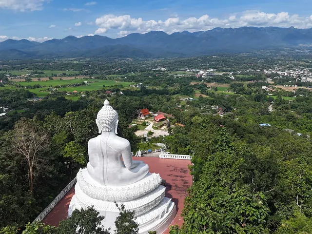
Make sure you navigate to the trailhead pin, not to the waterfall itself, and not to Wat Phra That Mae Yen (the White Buddha). The temple sits above the same village and shares the Mae Yen name, but it’s a completely different outing.
Most things on this side of town take their name from the water. Mae Yen means “cool river”: แม่ (mae) in front of a stream’s name is short for แม่น้ำ (mae nam, river), and เย็น (yen) means cool. Some travel blogs translate it literally as “cool mother”, which is wrong. The village of Ban Mae Yen, the White Buddha temple above it, and the waterfall (น้ำตกแม่เย็น) are all named after the stream.
The waterfall sits inside Huai Nam Dang National Park, even though the lower trail doesn’t. There’s no permanent ticket booth at the start, so the hike is usually free, but park rangers occasionally set up a folding table at the trailhead and collect the park’s 300 baht foreign entry fee. Carry the cash just in case.
What the walk is like
The first stretch leads through open farmland and orchards before the path enters the trees and picks up the stream. From there, the water is part of the route: expect to cross it around 30–40 times on the way in, and 30–40 times on the way back. The exact count shifts through the year as seasonal rain moves the gravel bars.
Your feet are going to get soaked within the first 20 minutes and stay wet all day. Wear trail shoes or sturdy hiking sandals with proper grip that you can comfortably walk in for hours once wet. Flip-flops are a bad idea on slick river stones and on the steep dirt climb near the end.
For the first 5 km, the valley floor climbs so gently it feels almost flat. Over the final 1–1.5 km, the trail leaves the streambed and climbs steeply over a forested spur before dropping down to the waterfall pool, so keep an eye out for where the path turns uphill rather than following the water indefinitely.
That final climb is one of three places where hikers lose the trail:
- The first 1.5 km: the path winds through orchards and irrigation ditches with farm tracks branching off in several directions, so it’s easy to lose the main stream early on.
- Around 3.8 km in: a dry, rocky side-ravine joins from the north and looks almost identical to the main riverbed.
- The final 1–1.5 km: where the trail leaves the water and climbs steeply up the bank over the spur.
If you don’t know the route, save a recorded Mae Yen trail track in an outdoor navigation app before leaving Pai, or go with someone who has walked it before. A standard offline Google Maps download will get you to the parking pin, but it shows nothing once you’re under the forest canopy.
At the waterfall
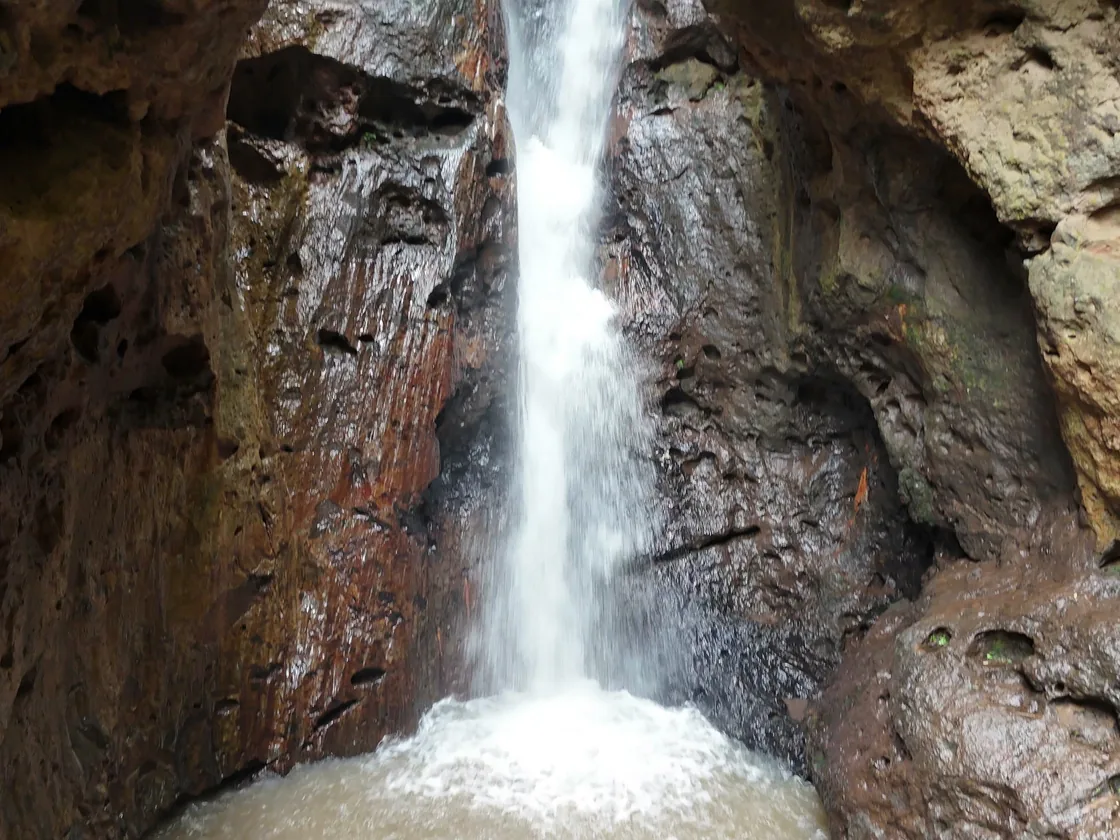
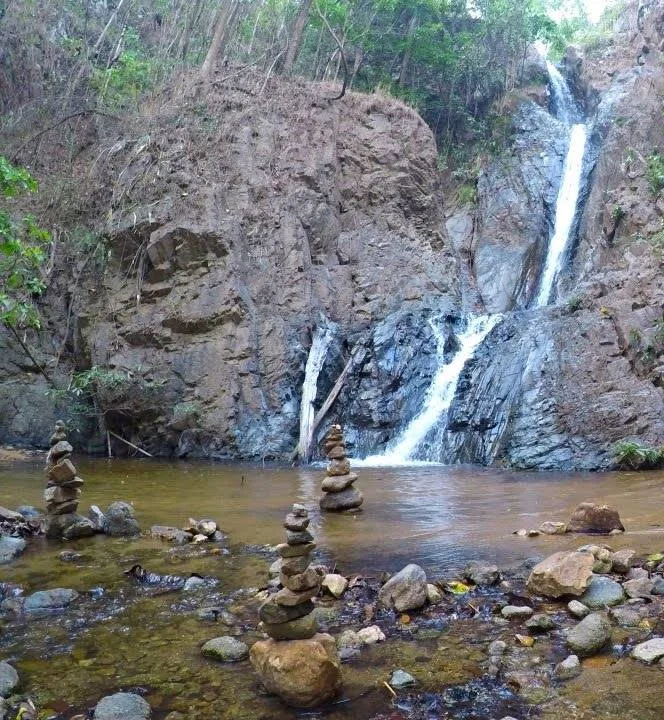
Mae Yen drops roughly 30 metres down a tall rock face into the pool below. Bring lunch and give yourself time to sit down when you arrive; after three hours of river crossings, there’s no reason to rush straight back. You can swim when the pool and current are calm, but judge the water as you find it.
Two things surprise people who’ve only read blog roundups: the water is properly cold, and the pool is shallow. A few online guides claim Mae Yen is fed by hot springs, probably confusing it with other sites in Huai Nam Dang National Park, but there are no hot springs on this stream. And because the hard rock here barely wears away while the stream keeps washing sand and gravel down from the hills, the basin fills in faster than the falling water can dig it out.
There are no food stalls, bins or toilets at the falls. Before settling in for lunch, check the time: start walking back from the waterfall by 2pm at the latest. The 6–7 hours is pure walking time, your break at the top is extra, and you don’t want to be coming down the steep spur or picking your way across 30 river crossings in the dark.
When to go, and when to turn back
November to January, the cool, dry months right after the rains, usually give you the easiest stream crossings, mild hiking weather and a steady waterfall.
During the rainy season (mid-May to mid-October), the waterfall is stronger, but heavy rain can turn an ankle-deep crossing into one you shouldn’t attempt. Because the upper catchment is steep rock and thin soil, a storm in the hills upstream can send water surging down the valley even when the sky above Pai looks clear.
Once you’re walking, keep an eye on the stream. It can rise 1.5–2.5 metres within an hour of heavy rain in the mountains, and once you’re inside the narrower sections of the valley there’s no way out up the sides. If the water starts rising or turns brown and muddy, turn back straight away. As a rule of thumb: if you’re waist-deep, you’re either off the trail or shouldn’t be out there.
During burning season (roughly March to May), haze builds in the valley and national park rangers can close forest trails for fire safety. Ask us at reception before you set out; if the trail is closed or the stream is running high, leave Mae Yen for another day.
What to take, and checking in with reception
Pack at least 2 litres of drinking water per person, a proper lunch and snacks for a full day’s hike, insect repellent, swimwear, and a dry bag for your phone and valuables. There are no shops, bins or toilets past the trailhead, so carry all your rubbish back out with you.
Don’t hike Mae Yen alone, and tell reception where you’re going and when you expect to be back. There’s no phone signal in the valley, so telling someone at the hostel is the only way anyone knows you’re overdue. If you’re not back when you said, we contact Pai Rescue and the Tourist Police.
Mae Yen or Hua Chang, and Pai’s easier waterfalls
If you like the sound of hiking up a jungle river without committing your entire day to a 6–7 hour trek, look at Hua Chang Waterfall instead. It gives you the same wild, river-crossing feel, 16 to 22 crossings each way to a cold plunge pool beneath an elephant-shaped rock wall, in a much more manageable 3–4 hours of walking.
If you’d rather skip wet shoes and river navigation altogether, head south into the cool rock gorge at Pam Bok Waterfall or spend an afternoon on the natural rock slides at Mor Pang Waterfall. You can compare all four side by side in our guide to Pai’s waterfalls.
Quick answers
How long is the Mae Yen Waterfall hike in Pai?
Allow 6–7 hours of walking time round trip from the trailhead, roughly 12–13 km return, plus extra time to eat and rest at the waterfall. You cross the stream around 30–40 times each way, and you should start walking back from the waterfall by 2pm at the latest to finish in daylight.
Is there an entry fee for Mae Yen Waterfall?
The hike is usually free because there’s no permanent ticket booth at the trailhead. But the waterfall sits inside Huai Nam Dang National Park, and rangers occasionally set up a table at the start to collect the park’s 300 baht foreign adult fee, so carry 300 baht in cash just in case.
Can you do the Mae Yen Waterfall trek without a guide?
Experienced hikers can do it without a guide in the dry season, as long as you never go alone, download a recorded trail track before leaving Pai (Google Maps offline doesn’t show the forest trail), tell your hostel reception when you expect to be back, and turn around by 2pm.
Should I hike Mae Yen or Hua Chang Waterfall?
Choose Mae Yen if you want a demanding, full-day jungle trek: 6–7 hours of walking, 30–40 river crossings each way and a steep final climb. Choose Hua Chang if you want a half-day jungle river walk, 3–4 hours of walking and 16–22 river crossings each way, that leaves your afternoon free.